
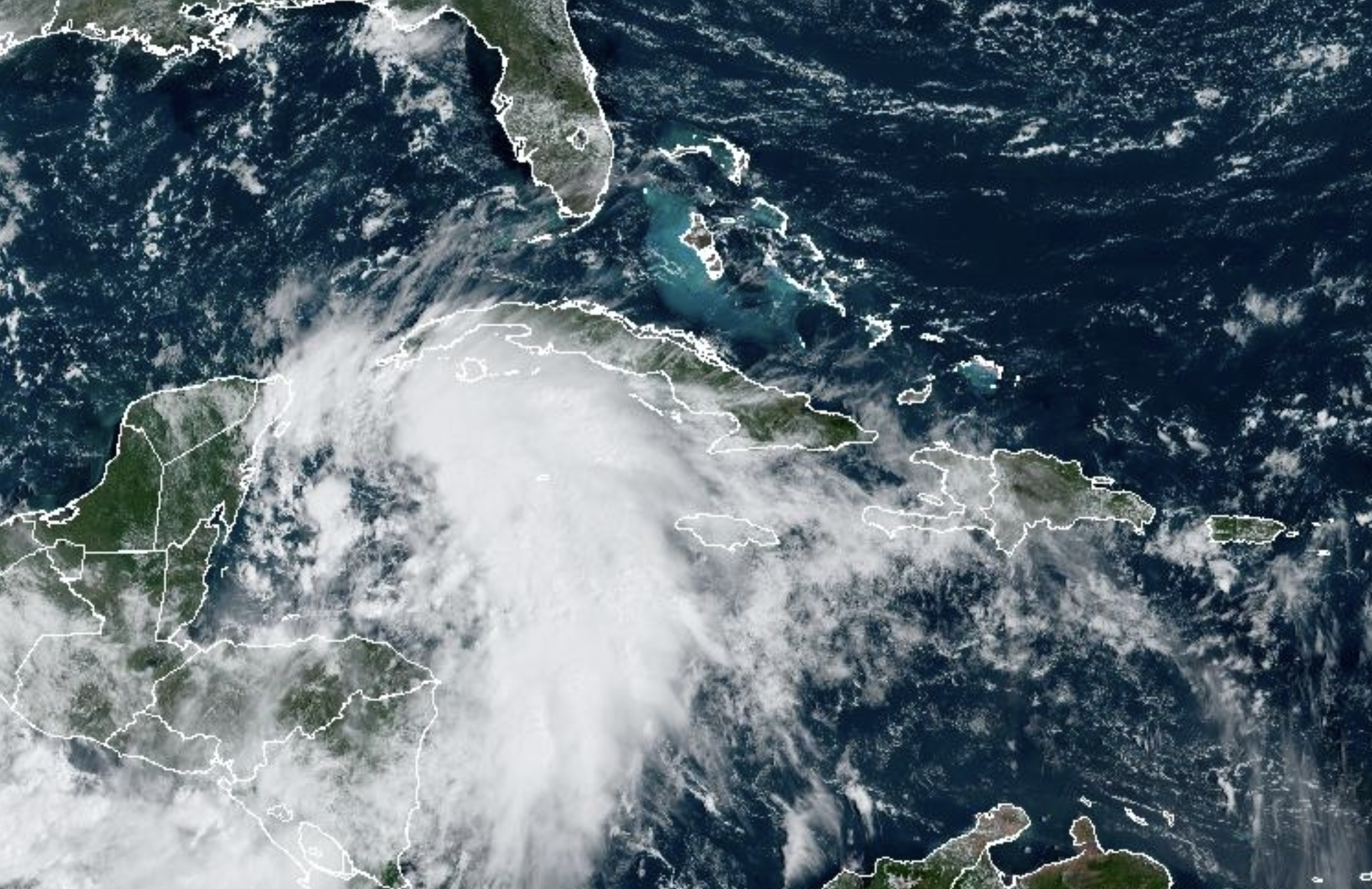
As expected, Tropical Storm Helene has formed in the northwest Caribbean Sea and will likely intensify into a "major hurricane," as it barrels towards Florida.
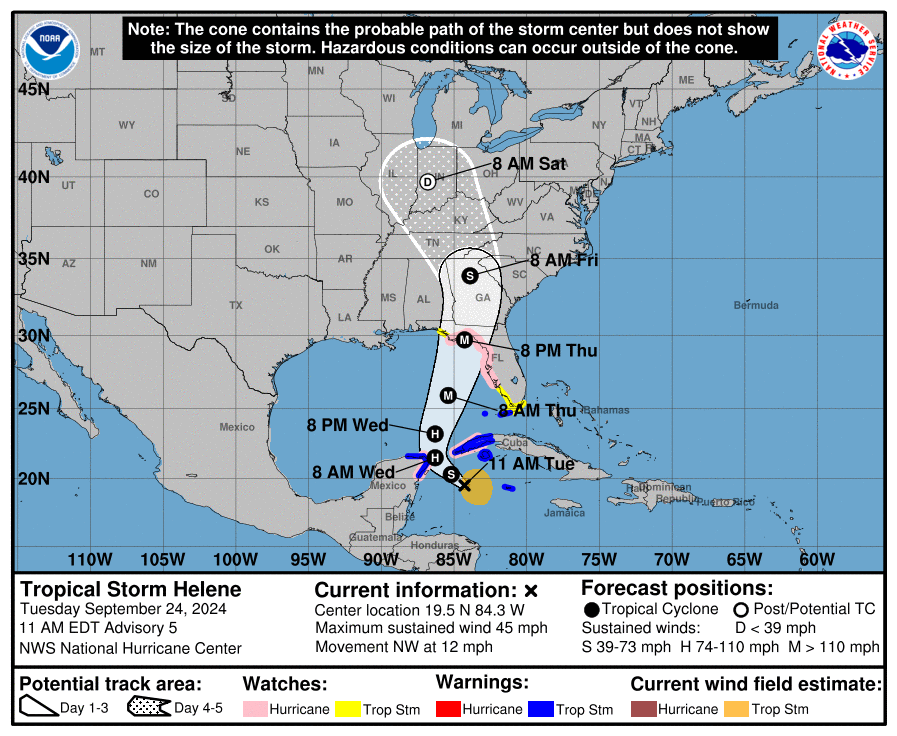
According to the 11a.m. advisory from the National Hurricane Center, Helene is now about 180 miles east southeast of Cozumel, Mexico and about 170 miles south-southeast of the western tip of Cuba. The storm is currently headed northwest at 12 mph, with sustained winds of 45 mph.
"Helene is forecast to intensify and be near hurricane strength when it reaches the far northwestern Caribbean Sea early Wednesday," says the advisory, adding that the storm is "expected to rapidly intensify over the eastern Gulf of Mexico and be a major hurricane when it approaches the northeastern Gulf Coast on Thursday."
Forecasters with the NHC say the center of Helene will move across the eastern Gulf of Mexico Wednesday and Thursday, potentially reaching the Gulf coast of Florida late Thursday.
Current tracks show Helene possibly making landfall in North Florida’s Big Bend region or in the Panhandle, with Tampa Bay staying slightly to the east. However, the NHC says the track could easily shift.
"The track guidance is very tightly clustered, which would normally imply high forecast confidence," says the NHC. "However, depending on exactly where the center forms could end up shifting the entire guidance suite in future cycles, so it is imperative to not focus on specific landfall locations this far in the future."
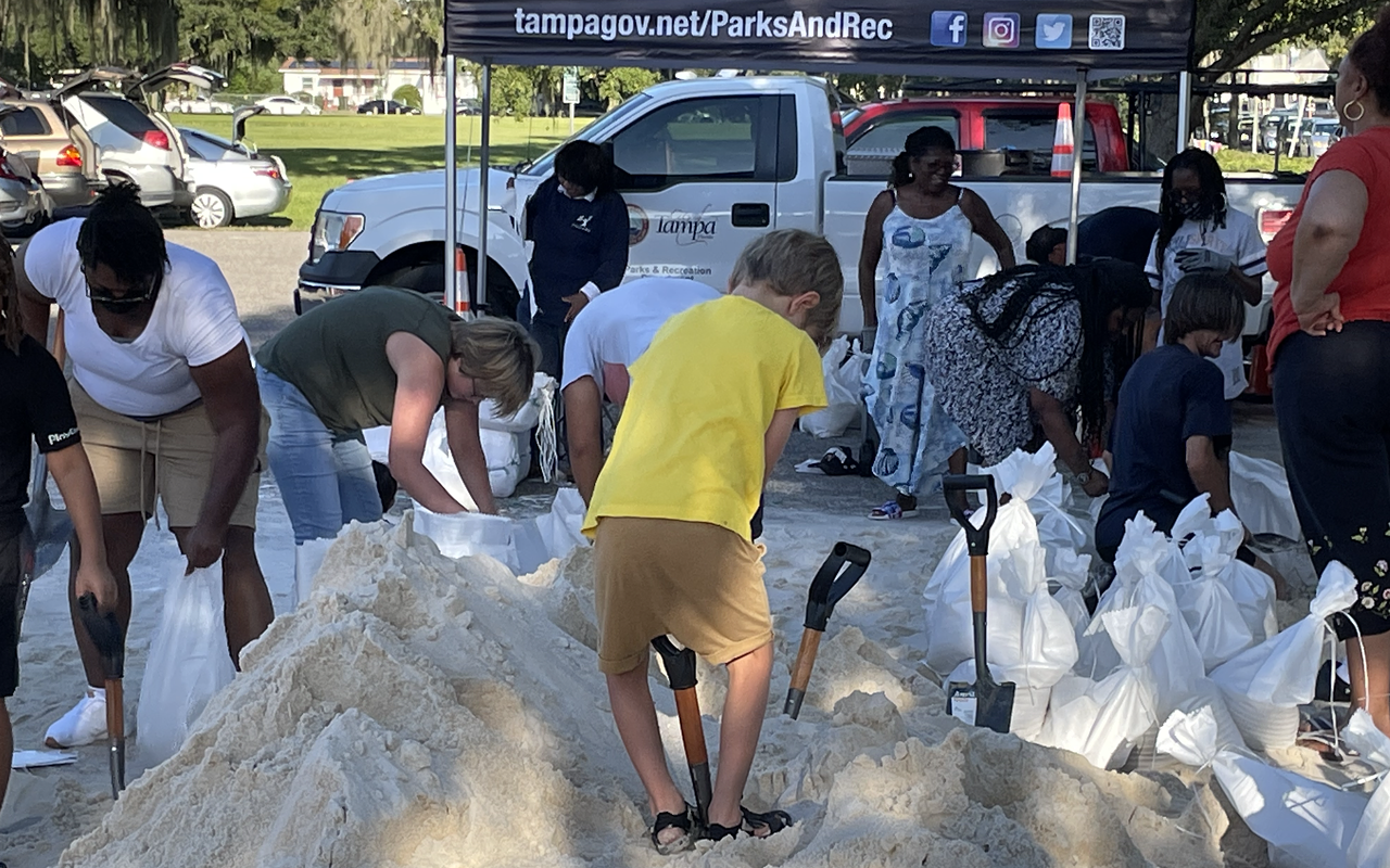
A storm surge watch and a hurricane watch are also in effect for the entire Tampa Bay region.
The storm's first rain bands are forecast to arrive in the Tampa Bay late Wednesday, then bring heavy winds and a possible four-to-eight inches of rain through Thursday afternoon, with isolated totals possibly reaching as high as 12 inches.
Forecasters are also predicting storm surge upwards of five-to-eight feet in the Tampa Bay region, with some areas closer to where the storm makes landfall reaching as high as 15 feet.
On Monday, Gov. Ron DeSantis declared a state of emergency for 41 counties, including Hillsborough, Pinellas, Manatee, and Pasco.
Tampa Bay's Best of the Bay-winning weatherman, Denis Phillips, is still not yet freaking out, however. "We're fine," he wrote on social media. "Whatever comes our way, we've got this as long as we stay informed and prepared."
Subscribe to Creative Loafing newsletters.
Follow us: Google News | NewsBreak | Reddit | Instagram | Facebook | Twitter
Tropical Storm Helene forms in Caribbean, while much of Florida remains in path
A storm surge watch and a hurricane watch are also in effect for the entire Tampa Bay region.
© 2024 Creative Loafing Tampa Bay
