
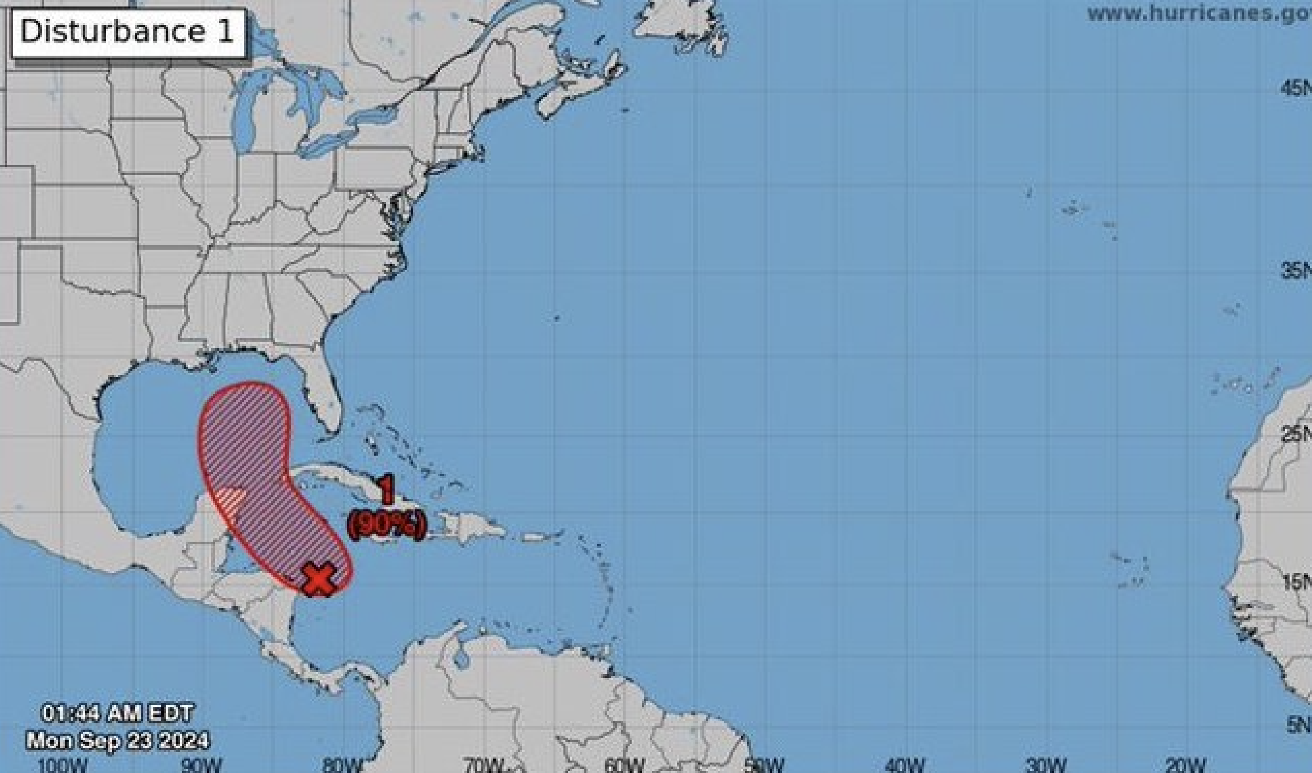
A tropical disturbance in the the Caribbean Sea has a high chance of developing into a major storm as it enters the Gulf this week.
Early this morning, forecasters with the National Hurricane Center (NHC) gave an area of low pressure, called Invest 97L, a 70% chance of development over the next 48 hours and a 90% chance of development over the next seven days.
According to the NHC, Invest 97L is currently located in the northwestern Caribbean, and is expected to move north into the warmer waters of the eastern Gulf of Mexico over the next few days, producing heavy rains over portions of Central America.
"Later this week, the system is forecast to move generally northward across the easternGulf of Mexico, and interests along the northern and northeastern Gulf Coast should also closely monitor the progress of this system," said the NHC.
As of now the track is uncertain, but if Invest 97L does develop it will be called Helene.
Locally, forecasters say to expect heavy rain starting Tuesday, with increased risks of flooding, storm surge and tornadoes beginning Thursday, especially near the Florida Panhandle or the Big Bend areas.
"Now is a great time to review your hurricane plans and check your hurricane supplies," wrote the Tampa Bay National Weather Service on social media.
Subscribe to Creative Loafing newsletters.
Follow us: Google News | NewsBreak | Reddit | Instagram | Facebook | Twitter
Tropical disturbance in Gulf has 90 percent chance of development this week, says forecasters
"Now is a great time to review your hurricane plans and check your hurricane supplies."
© 2024 Creative Loafing Tampa Bay
