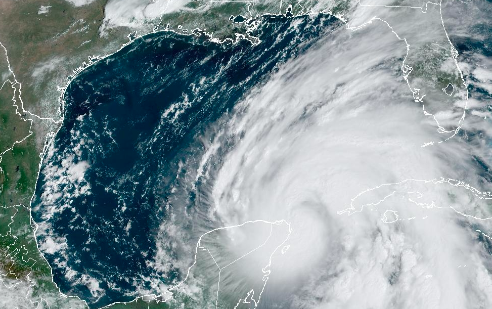
Tropical Storm Helene has officially been upgraded to a Category 1 hurricane, and is expected to intensify to at least a Category 3 as it heads north across the Gulf of Mexico today.
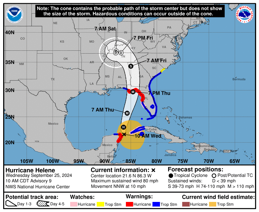
According to the 11 a.m. advisory from the National Hurricane Center, the storm is moving 10 mph about 500 miles south-southwest of Tampa, with maximum sustained winds of 80 mph.
Helene is currently moving toward the north-northwest, but the path is expected to shift this afternoon.
"A turn toward the north and north-northeast with an increase in forward speed is expected later today through Thursday," says the NHC, "bringing the center of Helene across the eastern Gulf of Mexico and to the Florida Big Bend coast by Thursday evening. After landfall, Helene is expected to slow down and turn toward the northwest over the southeastern United States Friday and Saturday."
Officials expect Hurricane Helene to become significantly wider, and reach a Category 3 storm or higher, with sustained winds of at least 111 mph, by the time it makes landfall along Florida's Big Bend region or in the Panhandle, with Tampa Bay staying to the east.
A hurricane warning is in effect from Anclote River to Mexico Beach. A hurricane watch is also effect for Tampa Bay. There's also a storm surge warning and a flood watch for Pinellas, Hillsborough, Pasco and Hernando counties.
As of now, Pinellas, Hillsborough, Pasco and Hernando counties have issued mandatory evacuation orders for some residents. Local cities and counties are also distributing free sandbags throughout today.
Officials are warning that Tampa Bay residents should make final preparations now, since Helene's bands are expected to arrive this evening.
Tampa Bay should see the worst conditions begin to materialize Thursday afternoon and into Friday morning, bringing gusts from 60-80 mph along the coast, and inland areas seeing gusts of 40-60 mph. Tampa Bay is also expected to see strong storm surge of 5-8 feet, as well as 5-10 inches of rainfall with some areas around 15 inches.
Localized flooding and tornadoes are also possible, warns the NHC.
Subscribe to Creative Loafing newsletters.
Follow us: Google News | NewsBreak | Reddit | Instagram | Facebook | Twitter